Destination Guide
Offline GPS Map for Komodo Boat Tours: Apps That Work
Key Facts
Essential information for your Komodo boat tour planning and navigation.
The most reliable tool is the Navionics Boating app paired with pre-downloaded Komodo MBTiles from the official GIS portal for precise depth and reef contours.
You can reach our customer support team by emailing info@yourcompany.example.com, calling +1 555-555-5556, or using the live chat on our website. Our dedicated team is available 24/7 to assist with any inquiries or issues.
We’re committed to providing prompt and effective solutions to ensure your satisfaction.
We offer a 30-day return policy for all products. Items must be in their original condition, unused, and include the receipt or proof of purchase. Refunds are processed within 5-7 business days of receiving the returned item.
Navigation Guide
Essential technical details for your journey through the park.
Primary GPS tool
Navionics Boating (iOS/Android) provides the best offline tracking.
Backup map source
Komodo National Park MBTiles (download directly from park.gov.id).
Depth coverage data
0–150m range available with precise 1m contour intervals for safety.
Battery life optimization
Use solar charging; a 10Ah power bank lasts 8 hours at full usage.
Optimal download timing
48h before departure, when Wi-Fi is stable at Labuan Bajo docks.
Are links to other websites approved?
Although this Website may be linked to other websites, we are not, directly or indirectly, implying any approval.
Why Offline Navigation Matters in Komodo
The seas around Komodo National Park are a tapestry of turquoise lagoons, basalt cliffs, and hidden reefs. When you step aboard a Phinisi charter, the scent of salty air mingles with the distant call of orange‑winged parrots. The park’s remote location means cellular coverage drops to a flicker once you leave Labuan Bajo harbor.
Relying on live maps can leave you blind to submerged hazards such as the Manta Point reef at 30m depth or the shifting sandbars near Batu Bolong. An offline GPS map gives you the tools to navigate safely.
Consistent depth readings for divers, fixed waypoints for island hopping, and total peace of mind when the signal fades, keeping your crew and guests safe at all times.
The Top Offline GPS Apps for Komodo Boat Tours
Below is a curated list of the apps I trust on every charter. Each entry includes a short description, platform compatibility, and a tip on how to integrate it with the Komodo offline map.
1. Navionics Boating (Premium)
- Platform: iOS, Android
- Why it shines: Offers downloadable nautical charts with 1 m depth contours, satellite overlays, and a “Live Weather” layer that can be cached for offline use.
- Integration tip: Import the MBTiles file (named Komodo_2025.mbtiles) via the “Import Charts” menu. The app automatically snaps your GPS to the chart’s georeference, giving you precise depth numbers even at 15 knots.
2. Google Maps Offline
- Platform: iOS, Android
- Why it shines: Simple to download entire regions (e.g., “Labuan Bajo – Komodo”) and keep them on the device. Great for land‑based waypoints such as the Batu Cermin viewpoint.
- Integration tip: Use the “Save” button on the map view, then add custom markers for your dock at Labuan Bajo Marina and the Komodo Airport.
3. MarineTraffic (Offline Mode)
- Platform: iOS, Android
- Why it shines: Provides AIS data that can be cached for up to 24 hours, allowing you to see nearby vessels even without a data connection.
- Integration tip: Enable “Offline AIS” in settings, then overlay the data on Navionics for a combined view of traffic and depth.
4. MAPS.ME (OpenStreetMap)
- Platform: iOS, Android
- Why it shines: Completely free, with vector maps that can be updated offline. Good for backup navigation on the coast.
- Integration tip: Download the “Indonesia – East Nusa Tenggara” region and add a custom layer in Navionics for redundancy.
5. Locus Map (Pro)
- Platform: Android only
- Why it shines: Supports MBTiles, GPX import, and has a built‑in “Track Recorder” that logs your route for post‑trip analysis.
- Integration tip: Load the same Komodo_2025.mbtiles and enable “Auto‑snap to chart” for smooth navigation through narrow channels.
How to Set Up Your Offline GPS Map – Step‑by‑Step
HowTo: Install and configure an offline GPS map for a Komodo boat tour.
- Choose a rugged device – I recommend a waterproof Android tablet with a 10,000 mAh battery.
- Connect to Labuan Bajo Wi‑Fi – Most cafés and the marina offer a stable 20 Mbps connection.
- Download the MBTiles file – Visit the official GIS portal at https://komodo.gov.id/gis and click “Download Komodo Offline Map (MBTiles)”. The file is ~250 MB.
- Install Navionics – Purchase the yearly subscription, then open the app and go to Settings → Charts → Import.
- Import the MBTiles – Select the downloaded file; Navionics will index the chart (takes ~2 minutes).
- Enable “Offline Mode” – In Navionics settings, toggle “Use Offline Data Only”. This forces the app to rely solely on the stored chart.
- Add custom waypoints – Tap the “+” icon, place markers at Padar Island, Komodo Island, and Rinca. Include notes like “Sunrise 06:30, low tide”.
- Sync with MarineTraffic – Open MarineTraffic, download the latest AIS cache, then enable “Overlay on Navionics”.
- Test the system – Before leaving the harbor, run a short 5‑minute “track recording” to verify GPS lock and chart alignment.
- Pack a power bank – A 20 Ah solar‑charged pack ensures you stay online for the entire 2‑day itinerary.
Insider Tips from the Waterline
- Best time to download: Early morning (06:00‑08:00) when Labuan Bajo’s internet traffic is low. The download speed spikes, reducing the chance of a corrupted MBTiles file.
- Tide considerations: The Komodo Strait experiences a semi‑diurnal tide. Aim to cross the Senggigi Channel at slack tide (usually around 10:30 am or 22:30 pm) to avoid strong currents that can push a boat off course.
- Ask your charter operator: “Do you keep a hard copy of the latest depth chart for the southern reefs?” Most Phinisi owners keep a printed Komodo Hydrographic Survey booklet; use it as a backup.
- Battery preservation: Dim the screen to 30 % brightness and enable “Battery Saver” on Android. The GPS chip uses minimal power when the screen is off, yet you’ll still receive audible depth alerts.
- Safety first: Keep a VHF radio tuned to channel 16 and a PLB (Personal Locator Beacon). Even with perfect offline maps, a sudden squall can force an emergency stop—your PLB will be the lifeline.
Frequently Asked Questions (FAQ)
What is the difference between an offline GPS map and a regular online map?
An offline GPS map stores the entire chart on your device, allowing you to view depth contours, waypoints, and satellite imagery without any internet connection. A regular online map streams data in real time, which can be interrupted by weak cellular signals—common in the remote archipelago of Komodo.
Can I rely solely on a smartphone for navigation in Komodo National Park?
While a smartphone with a good offline map can get you from point A to B, a dedicated nautical app like Navionics provides depth soundings, tide predictions, and AIS overlays that are essential for safe marine navigation. I always carry a separate rugged tablet for redundancy.
How often are the Komodo offline maps updated?
The park’s GIS office releases an updated MBTiles file twice a year, typically in March and September. The updates include new reef surveys and corrected depth data after monsoon‑season shifts.
Is there a free alternative to Navionics for offline navigation?
Yes— MAPS.ME and Locus Map (Free) can display vector charts, but they lack the high‑resolution depth contours (1 m intervals) that Navionics provides. For a professional charter, the modest subscription fee is worth the safety margin.
What should I do if my GPS loses signal while out at sea?
First, stay calm. Switch to the backup Google Maps Offline view, which still shows your last known position. Use the VHF radio to request a bearing from nearby vessels or the park’s patrol boat. If you have a PLB, activate it as soon as you suspect you’re off‑track.
Mapping the Iconic Routes – Sample Itinerary with GPS Highlights
Below is a typical 2‑day charter route, annotated with GPS coordinates and depth notes. All points are pre‑loaded in the Navionics chart.
Expedition Logbook
Review coordinate data, dive depths, and notable features for each waypoint during the two-day expedition.
Day 1 Route
Departure point from Labuan Bajo Marina. Anchor securely with 2-meter chain before initiating journey.
View Map- Batu Bolong (west)
- Depth 18 meters
- Shallow reef zone
- Watch for turtles
Day 1 Highlights
Panoramic viewpoint at low tide. Best photography conditions at 06:30 for optimal lighting.
See Data- Komodo Island
- Depth 30 meters
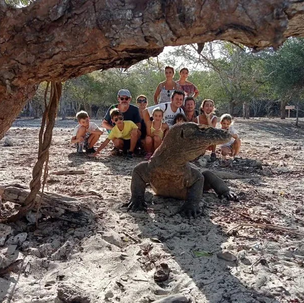
- Komodo dragon sightings
- Snorkel zone at 5m
Day 2 Itinerary
Trailhead base for guided treks. Observe local fauna and terrain with a professional park guide.
Full Details- Manta Point
- Depth 20-30 meters
- Manta ray habitat
- Return to dock by sunset
Choosing the Right GPS App
Select the perfect navigation tool for your unique charter requirements.
Navionics Boating
Features 1m contour intervals and high-resolution satellite map overlays.
MAPS.ME
Provides free OpenStreetMap vector data without requiring a subscription.
Locus Map (Pro)
Ideal for professional track logging, GPX exports and offline support.
MarineTraffic (offline)
Offers reliable real-time vessel traffic using cached AIS data for 24h.
Google Maps Offline
A simple and familiar interface for managing custom land waypoints.
Navigating Komodo
Explore the sensory experience of navigating through Komodo with offline maps.
Navigate the Untouched Seas
Experience the gentle hum of the Komodo waters under the stars. Our navigation tools guide your journey through marine sanctuaries with the precision of a lighthouse beam.
- Downloading a corrupted MBTiles file – Verify the file size (≈250 MB) and checksum (MD5 provided on the GIS portal) before importing.
- Relying on a single device – Always carry a secondary phone with Google Maps Offline as a fallback.
- Ignoring tide tables – Use the Indonesian Marine Agency tide calculator; crossing the Senggigi Channel at high tide can add an extra meter of current.
- Battery drain – Turn off Wi‑Fi, Bluetooth, and background apps. A solar charger positioned on the deck’s shade side keeps the tablet alive.
- Not updating the chart – Schedule a monthly reminder to check the GIS portal for the latest Komodo offline map release.
How to Keep Your Offline GPS Map Fresh
- Set a calendar reminder for the 1st of March and September to download the newest MBTiles.
- Subscribe to the park’s newsletter (free) for alerts about temporary navigation hazards, such as coral bleaching events that may alter reef topography.
- Sync with your charter operator; many Phinisi owners already have the latest chart printed on waterproof paper—compare it with your digital version before each trip.
The Future of Navigation in Komodo
The Indonesian Ministry of Marine Affairs is piloting a real‑time satellite‑based AIS system that will eventually allow offline devices to receive updates via a low‑bandwidth satellite link. While still in testing, this technology promises to eliminate the need for pre‑downloaded charts altogether. Until then, a well‑prepared offline GPS map remains the most reliable tool for safe and awe‑inspiring boat tours across Komodo’s rugged seas.
Ready to Set Sail with Confidence?
Navigating Komodo National Park without a reliable offline GPS map is like diving without a mask—possible, but far from enjoyable. By equipping yourself with Navionics, the official Komodo offline map, and a few practical tips, you’ll glide through turquoise lagoons, discover hidden reefs, and meet the legendary Komodo dragons with the peace of mind every seasoned charter crew deserves.
Book your Phinisi charter today and let us handle the navigation while you focus on the unforgettable sights and sounds of Komodo. Visit our boat charter page to choose the perfect vessel, or explore our guide to the best dive sites for a deeper adventure. Your journey begins with a single click—let’s make it unforgettable.